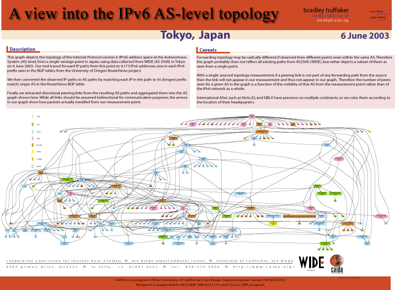
We used scamper , a tool similar to traceroute, to probe forward paths from a host at WIDE (Tokyo, Japan) to a world wide set of IPv6 destinations. The IPv6 addresses in these paths were mapped to ASes using the Border Gateway Protocol (BGP) routing tables provided by the University of Oregon's Route Views project. We determined the geographic location of the ASes from the CAIDA's NetGeo database.
- asymmetry - Topology of forwarding paths maybe radically different from that of return paths.
- path conformity - Forwarding topology may change if observed from different points even within the same AS. Therefore, the graph does not necessarily reflect all existing paths from WIDE's AS 2500, but depicts a subset as seen from out monitoring point.
- hidden paths - Unless a peering link is in the direct path between the monitor and the target destination, our tool will not find it. Thus the outdegree of an AS in our graph shows its importance for our point of measurement rather than for the IPv6 network as a whole.
- country - Although our graph displays a single country for each AS, some ASes actualy span multiple national boundaries. For simplicity we assume that the center of gravity of an AS is in its country of origin and thus display the country where the headquarters of a given AS resides.
Caveats
References
[BGP] K. Lougheed and Y. Rekhter, RFC 1106, "Border Gateway Protocol (BGP)" [RouteView] Meyer, D. University of Oregon Route Views Project. [NetGeo] Moore, D., R. Periakaruppan, J. Donohoe, and K.C. Claffy. "Where in the World is netgeo.caida.org?"
Acknowledgments
This work is supported by the NCS/NSF ANI-0221172 and Cisco's URP program.


